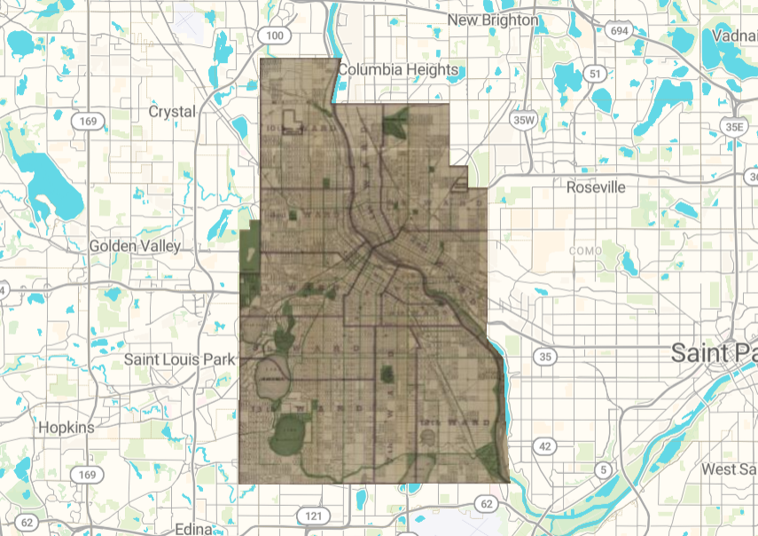
https://viewer.allmaps.org/?url=https://annotations.allmaps.org/images/e90b5231f29a0fe9
I really enjoyed the process of using AllMaps. It honestly changed my understanding of the spatial DH projects we explored in class, because a lot of them are really impressive, but AllMaps was so easy to use that it made me realize that the projects don’t have to be made by expert cartographers or anything like that. Having tools like AllMaps makes digital humanities work a lot more accessible, similarly to the data visualization tools like RAWGraphs we used earlier in the term.
Once you have a georectified map, you can analyze differences between the historical and present-day details. This can bring up important historical comparisons, which don’t even necessarily have to be limited to the academic discipline of history. There can be interesting information related to environmental questions, infrastructural plans, demographic information, and much more. It relates one map to another, locating a standalone map section within a broader digital context.
There are some issues, such as inaccuracies when it comes to large changes in landscape and infrastructure. A lot of what I based the georeferencing points on were street names/intersections, which worked out well, but if the map were a lot older, or larger changes occurred between the historical map and present day, it’d be harder to georeference. Even with the map I used from 1914, which is definitely old but relatively a bit more recent, I noticed differences in street names and even bodies of water.