By: George Norsman, Evan Olds, and Myles Swisher
Japanese garden ArcGIS map
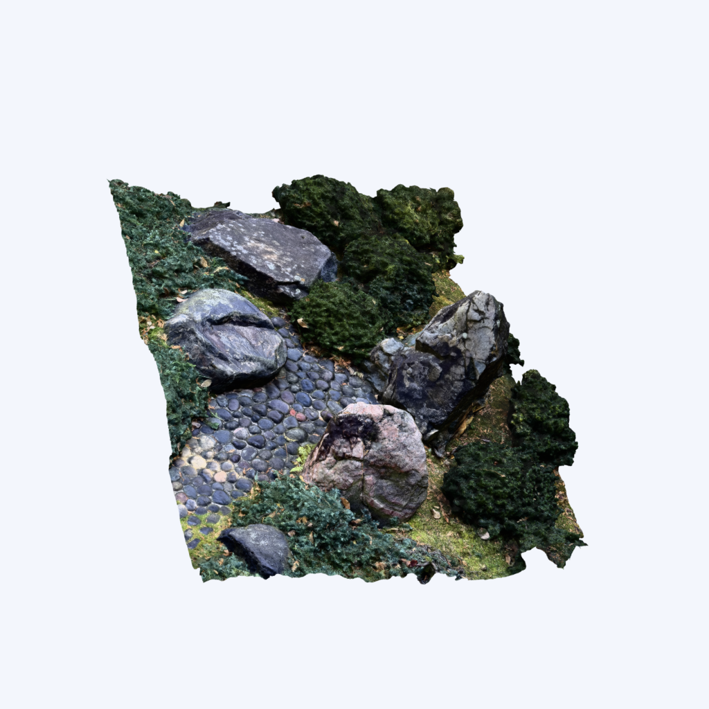
Stone Mountains Metashape
Reflection Questions
How does attempting to model a building compare to simply viewing one through photographs or maps?
Creating a 3D model required a much deeper understanding of the feature than simply looking at photographs or a map. While photographs capture only specific angles and maps show location and shape, photogrammetry required us to examine the feature from many perspectives and consider how each part connects spatially. By building the model, we gained a better understanding of the scale, texture, and arrangement of the stone mountains and how they relate to the surrounding stream and garden landscape.
Does the process of photogrammetry encourage close looking and attention to details you might otherwise have ignored?
Yes, photogrammetry encouraged us to closely examine details that would normally be overlooked. When capturing images, we had to pay attention to the shape, surface textures, shadows, and positioning of individual rocks to ensure the model was accurate. This process highlighted small variations in the stones and helped us better understand their symbolic role as the origin of the dry stream. The detailed observation required by photogrammetry made us appreciate the intentional design elements of the Japanese Garden more than we would have through casual observation.
Brief Description of the Feature
Located on the southeastern edge of the garden, the Stone Mountains are a collection of medium-sized rocks positioned near the stream. The rocks serve as the symbolic source of the dark stone stream, representing the point from which water would naturally flow and contributing to the garden’s overall aesthetic and symbolism.
Hi! Your model looks super fascinating! It seems like a particularly tricky feature to capture since you had to take photos from multiple angles to build a complete view of those stone mountains through photogrammetry, but it turned out amazing! I completely agree that building 3D models gives us insights into details we might miss in flat photos—like scale, texture, and spatial arrangement, especially across a combined set of features.
Hi!
I really like how your group’s model turned out of the Stone Mountains!
I agree with you that creating a 3D model of an object requires a deeper comprehension of the object rather than simply looking at a 2D image of it. I had a similar experience as you while completing the photogrammetry data set. I had to be careful to consider all of the different angles of my object as well. I can imagine your object would be difficult to model with the various rocks.
I think your group did a great job capturing the Stone Mountains in 3D, especially since the different rocks probably made it challenging to get all the details. I also liked how you explained their role in the Japanese Garden and how they symbolically represent the source of the stream. It’s interesting to see how much thought goes into the design of this space!
I liked your point that creating a 3D model forces you to understand a feature more deeply than just looking at photos or a map. The part about noticing textures, shadows, and the positioning of individual rocks stood out to me because those are details that would be easy to overlook otherwise. I also thought it was interesting how the modeling process helped you connect the physical layout of the Stone Mountains to their symbolic role in the garden.
I really loved the map! I thought it was super accurate to how the Japanese Garden actually looks in real life. I especially liked how you guys captured the placement of the Stone Mountains in relation to the stream and the rest of the garden. I also thought it was interesting how you explained that the rocks symbolize the source of the stream, which is something I never really thought about when walking through the garden. Overall, I thought you guys did a great job capturing both the physical layout and the meaning behind the space!
It was interesting to see the way in which you used photogrammetry in studying the Stone Mountains and their importance to the Japanese Garden. I found it cool the way you discussed how the rocks are symbolic for the source of the stream. How well does the 3D modeling allow us to understand the symbolism?