As for my lab this week, I decided to use Allmaps Editor to georeference the old map of Minneapolis and compare it with a new map of the city. The procedure was done by locating various spots in the old map and finding where these spots were located in the new map. After that, I simply overlaid the old map over the new one and compared the difference in the streets and geography of the city.
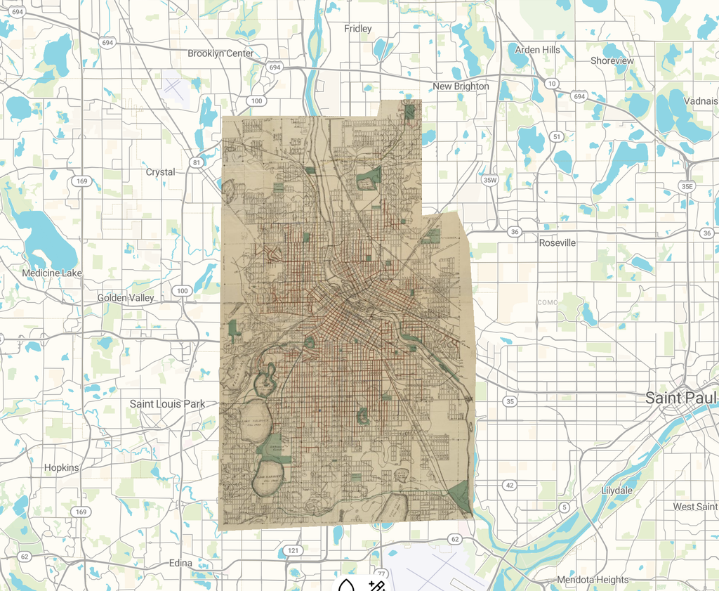
Map of Minneapolis, Hennepin County, Minnesota / Allmaps Viewer
One of the most intriguing aspects of this whole procedure has been the comparison between the historical street grid and the contemporary one. The Mississippi River and the lakes in Minneapolis are also among the recognizable landmarks on both maps. Yet not all the areas of the historical map corresponded to those on the contemporary one.
The exercise has helped me see spatial digital humanities projects differently. Prior to this lab exercise, I had a very one-dimensional idea of what a map was, in that it served as an effective way to present historical data. The process of georeferencing opened my eyes to the possibility of using historical maps to study urban development throughout time.
A final interesting aspect of Allmaps is that georeferenced maps can be viewed in alternative forms. In addition to being able to view the output in Allmaps Viewer, georeference annotation data is available in the form of IIIF Georeference Annotation in JSON-LD, and XYZ map tiles will enable the use of the map in other geographic programs. This opens up possibilities for further studies, for example, analyzing the connection between urban development and population growth through the comparison of historical maps and census records.
However, georeferencing does have its limitations as well. Maps from the past can carry mistakes, and landmarks or streets may have been altered since then. Also, it is worth noting that maps always depend on the interests of their makers, which means that particular areas can be ignored. Therefore, georeferencing alone cannot be used to research the experiences of people and the socio-historical context of neighborhoods.
In summary, through this experiment, I was able to appreciate how georeferencing can enhance historical maps for research in the digital humanities. Even though georeferencing is not without its weaknesses, it offers an engaging perspective on the development of cities over time.
I really enjoyed reading your reflection on the georeferencing process. Your discussion of comparing historical and modern street grids in Minneapolis clearly shows how maps can be used as analytical tools rather than just visual references. I also appreciated your acknowledgment of the limitations of georeferencing, especially the potential inaccuracies and biases present in historical maps. The connection you made between mapping, census data, and urban development highlights some exciting possibilities for digital humanities research and demonstrates the value of spatial analysis for understanding historical change.