Introduction
For this assignment, I georectified a map of Minneapolis from 1893. I found it to be a bit difficult, as I was unsure how to use AllMaps. I initially found it hard to draw the mask for the map, but I eventually realized it was easier than I thought.
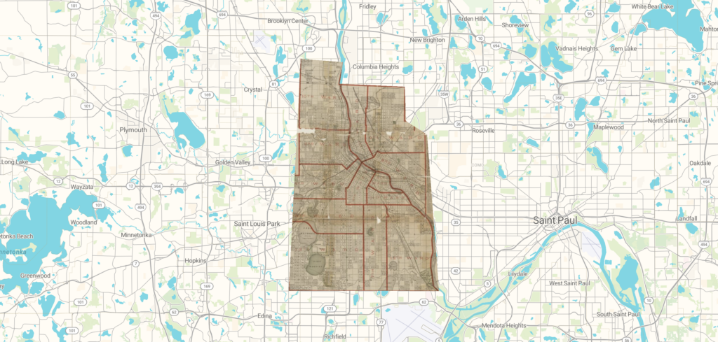
This is an image of a georectified map of Minneapolis.
understanding of spatial dh projects
This process definitely changed my understanding of spatial DH projects. I found that the process was more challenging than I assumed, which made my appreciation grow for spatial DH projects. It took me a while to figure out how to georectify a map of Minneapolis, which made me especially appreciative of larger-form spacial DH projects.
Formats to access the map in
The map can be accessed in a few different formats. It can be exported through the AllMaps Viewer, GeoReference Annotation or XYZ Map Tiles. It can also be transformed either as a polynomial shape, a thin plate spline, or a helmert.
Possibilities of a georectified map and next steps
I can see several possibilities of a georectified map. For example, a georectified map ties the original image to a digital platform which makes it easier to place on a world map. A georectified map could also be used for a larger map project to develop data about multiple different locations. Next steps would include editing the map to be more specific, and comparing the map to different Minneapolis maps to find the best set of data for my intended purpose.
Problems with georeferencing to consider
One problem with georeferencing is that it can be inaccurate. It requires different points to be placed in specific locations, which could lead to inaccuracies. Georeferencing could also lead to projects that are biased. If the original map they chose had biases, the final project could have biases as well.
Research areas this method wouldn’t be appropriate for
This method wouldn’t be appropriate if someone is trying to create a new map entirely from scratch, rather than referencing an old one. In addition, it wouldn’t be appropriate to learn the geography of an area in-depth, as it doesn’t require labeling to be done by hand like a traditional map does.