For this activity, I took this map of Minneapolis from the Minnesota Digital Library and rectified it using Allmaps Editor.
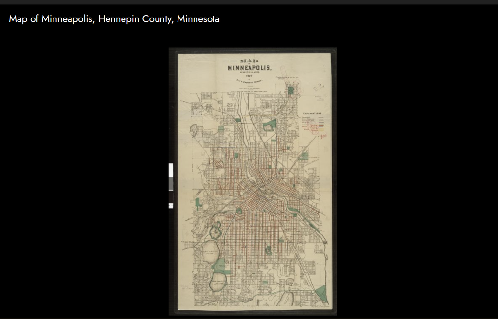
To be honest, I didn’t think much about mapping at all before this week’s lessons. For instance, thinking of maps as argumentative really reframed the way I looked at them, especially after working with one myself. For instance, I previously looked at the Mapping Gothic France project; I thought it was interesting, but I didn’t really think about it in terms of rhetoric or presentation. After rectifying my own map, however, I began to think more critically about why the original map might have been made and for what specific purpose. Remembering the Mapping Gothic France project, I started to wonder what purpose the researchers had in mind when they made those maps, allowing me to think about the project more deeply.
Being able to georectify maps opens up plenty of possibilities for research; for instance, with my Minneapolis map, I am able to compare the map of the city back in 1897 to how it looks today and examine where it fits within the rest of the world. Under the maps tab, I can transform my map from polynomial to thin plate spine or helmert, letting me view it in different formats, and I can change the background map under settings to see how it looks against different map designs.
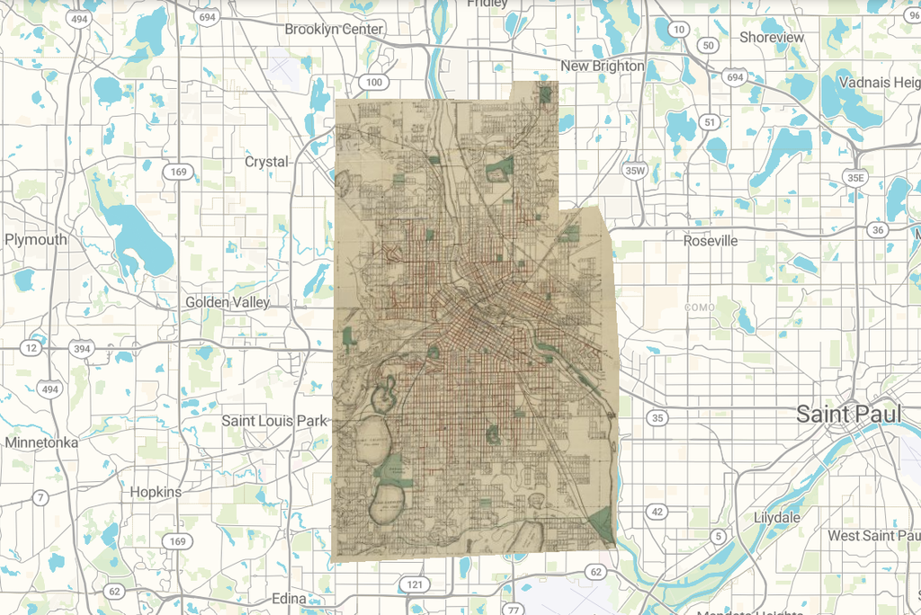
However, the process of georectifying maps is not without its flaws; it is important to be mindful of the changes in the landscape between when the first map was created and current times. Neither map is guaranteed to be one hundred percent accurate—human error could very well account for some of the differences between maps. Furthermore, this method is not a catch-all. For example, georectifying would not work for questions that involve historical features that you can’t access anymore on current maps, as you wouldn’t be able to rectify the map properly, which could be misleading.
Overall, this process taught me a lot about maps, and how to think about them. I would recommend looking at Allmaps—or the georectifying process—for anyone interested in spatial analysis.
Look at my map on Allmaps with this link.