For my week 5 Lab I mad an interactive map through ArcGIS and I chose five places at Carleton which are special to me: Laird Stadium, Gould Library, the Rec Center, the CMC, and Sayles-Hill Campus Center. Each of these locations represents a different aspect of my college experience, including academics, athletics, work, and social life.
My Interactive Map and Data:
View My Campus Locations Spreadsheet
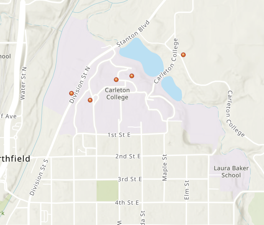
For the development of my map, the first step was to get the latitude and longitude coordinates of all locations using Google Maps. Once this was done, I would arrange the information in the form of a spreadsheet and use this information to place all locations on the ArcGIS map. Once the locations had been placed on the map, I would create an interactive map using ArcGIS Instant Apps.
The reason why I picked these five places is that they are reflective of the way I spend most of my time on campus. One place that is very special to me is the Laird Stadium since playing football has been a major component of my collegiate life. The Recreation Center is another place that is important to me because it is the place I work.
One of the things I enjoyed about this assignment was the transformation of a rather simple spreadsheet into a dynamic map. Before this lab assignment, I had not really considered how geographic coordinates can be used to communicate a personal narrative. All the five locations plotted together enabled me to realize their significance in my campus life routine.
I feel that it can also serve a useful purpose in doing research in digital humanities. One can take similar methods to look at how the Carleton campus has developed over time or how the functions of various buildings have evolved. The map is helpful in understanding this information better.
In summary, the lab taught me the power of geographic data for sharing knowledge and storytelling. Moreover, it offered me an alternative viewpoint on the places I visit nearly everyday.
Stefan, I like how you chose locations that represent different aspects of your experience at Carleton, especially how Laird Stadium connects to your experience playing football. It’s interesting how mapping these places can turn a simple set of coordinates into a personal story. I also agree that this type of mapping could be useful for studying how campus spaces are used and change over time.