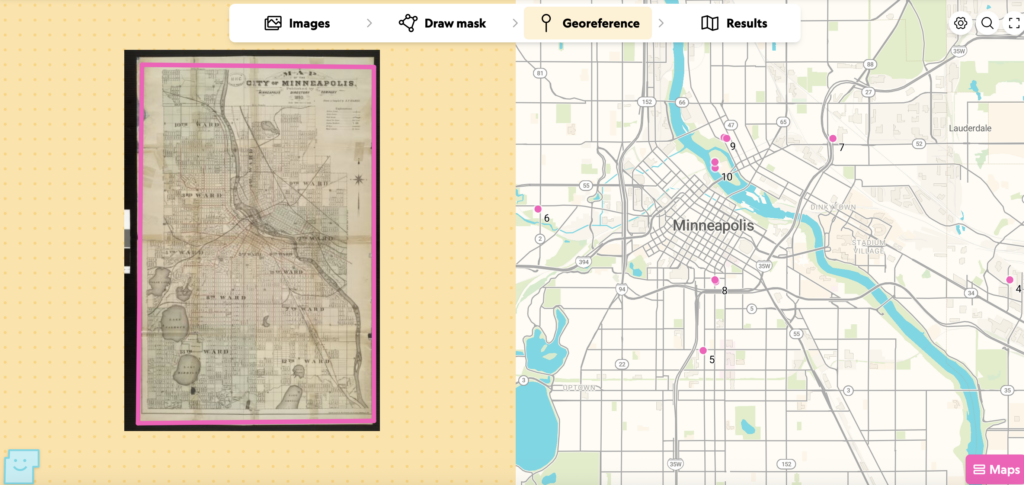
Hands-on georeferencing through AllMaps fundamentally reshapes how I view spatial Digital Humanities (DH) projects like Mapping Past Societies or Mapping Inequality. Viewing finished GIS applications often creates an illusion of seamless, objective spatial truth, but working through georeferencing reveals that every layered digital map requires human intervention to match historic control points to modern coordinate systems. Working with this 1893 map of Minneapolis, matching historic street layouts, river bends around Nicollet Island, and rail corridors to modern basemaps, illuminates the labor, subjective choices, and critical interpretations required to transform static historical artifacts into interactive spatial data.
When examining the AllMaps Map page, the tool provides access to several critical export formats for the georectified map. These include IIIF Manifests and Annotation standards that enable interoperability across digital repositories without downloading massive static files, georeferenced Web Map Tiles (such as XYZ or TileJSON) for web integration, and GeoTIFF or vector outputs for deeper desktop GIS analysis in platforms like QGIS.
Once a historical map like this Minneapolis atlas is anchored to real-world coordinates, key analytical possibilities emerge. Georectification bridges past cartography with contemporary spatial data, allowing researchers to overlap historic street grids, land ownership maps, or environmental data directly onto modern satellite imagery to track Minneapolis’s rapid late-19th-century urban expansion, industrial waterfront development, or neighborhood shifts. Furthermore, pairing georectified maps with census data, oral histories, or archival records helps visualize localized historical patterns like segregation or industrial zoning. As a next step, integrating these tile layers into a web interface alongside custom vector annotations or pop-ups can build narrative-driven historical arguments.
However, georeferencing presents critical limitations and biases that must be considered. Historic maps rarely adhere to modern Euclidean geometric projections, so forcing a historical map onto modern coordinates distorts the original document, stretching physical features and obscuring the cartographer’s intent. Moreover, because maps are inherently non-neutral representations embedded with power dynamics, georeferencing risks bestowing a false sense of modern scientific authority onto historical maps by validating municipal boundaries or commercial development maps as objective geographic facts. Consequently, this quantitative spatial method is not appropriate for research focused on subjective, fluid, or unmapped historical spaces, such as indigenous conceptualizations of the Mni Sota Makoce landscape, transient migratory communities, oral border traditions, or perceptual geographies that actively resist rigid grid coordinates.