I really enjoyed the process of creating a georectified map in Allmaps. However, it was not all totally intuitive. The process of creating this map definitely altered my understanding of the Digital Humanities projects which I had previously explored, because it made me realize that in order to accurately apply a historical map to a modern digital one, you have to quite meticulously reference a large number of equivalent points. For me at least, it took a while to figure out which points I needed to add so that my georectified map was not lopsided (although despite my best efforts it is still at a slight angle) or at an otherwise incorrect orientation in relation to the modern digital map. Thus, I realized through this process how intimate of an understanding the creators of other maps I had seen had to have had of both the modern digital map, and the historical map in question, and in turn the similarities and differences between the two.
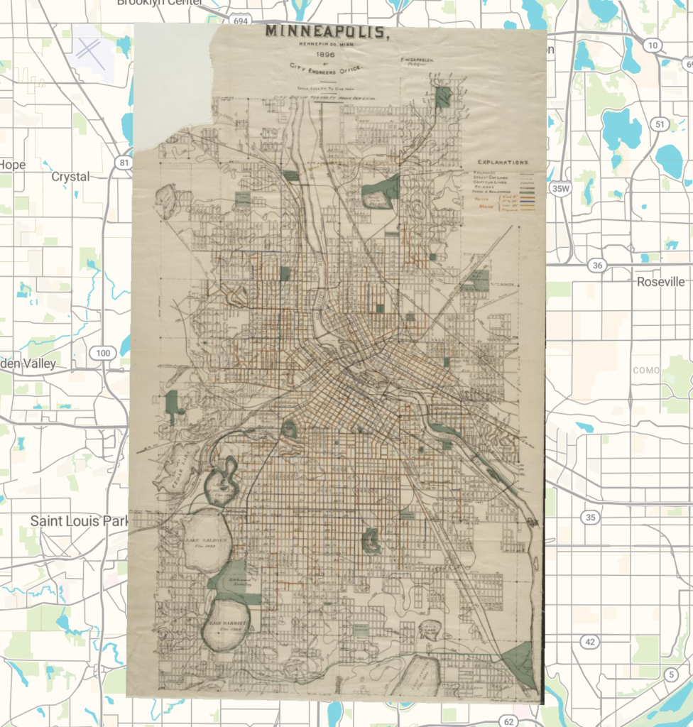
As far as the possibilities of this map go, there are certainly a couple that immediately come to mind. I find it really cool that you can adjust the opacity of the overlaid historical map, which could be used to highlight similarities and differences between these two eras of Minneapolis, and what has changed and what has stayed the same. Furthermore, I think it would be really useful to be able to isolate the street lines drawn on the historical map, and get rid of all the negative space, in order to further highlight the kinds and extent of development that has occurred since the historical map was made.
However, I think it is important to acknowledge some potential dangers of georeferencing. These pitfalls are ultimately dependent on what sort of map is being referenced. All maps aim to emphasize something in particular, or to serve a specific purpose, and in doing this they inevitably leave out a huge amount of information. Therefore, not only is it important to recognize the spatial biases present in whatever historical map is being used, which is dependent on the original purpose and mindset the map was a product of, but it is crucial to be wary, as a viewer of any georeferenced map, of the fact that anyone could easily attempt to tell a misleading story by claiming one particular georeferenced map to display a total truth of some sort. Thus, it is also true that the same georeferenced map could prove useful for some areas of study, but useless for another. Ultimately, the key to avoid any of these potential problems lies in understanding not what a map shows, but what it leaves out, and why.