In my attempts to geo-reference this map — Rand McNally & Co.’s map of Chicago : no. 3 — from the Leventhal Map & Education Center, I have gained great respect for other users of Allmaps and the creators of the Mapping Inequality project. Even with the intuitive design of Allmaps’ masking and control points tools, it is quite the process to search around both the modern and older maps to look for locations in common. Considering how cities and other places change over the decades (and sometimes centuries) after the older map has been created, process of matching these control points to precise locations must take some time and finesse on the part of digital humanities scholars. After setting eight control points, this was my resulting map.
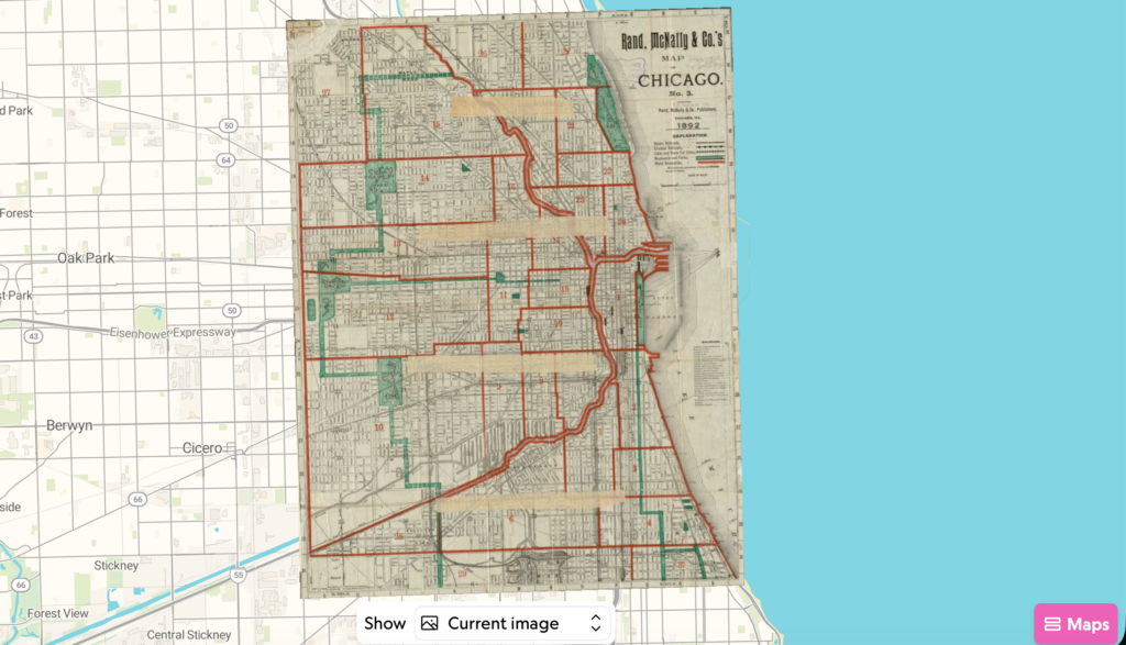
While most of the map seems to be aligned with the shoreline and streets, the Chicago river to the south and a few roads to the west are not aligned exactly. When switching the transformation of the map to a Helmert style, the roads and river seem to align much better. Switching the opacity of the Rand McNally map gives a better understanding of both how certain sections of Chicago were divided long ago and how the represented places match up with modern cartography. The Leventhal Map & Education Center also has a better geo-referencing of the same map linked on their site.
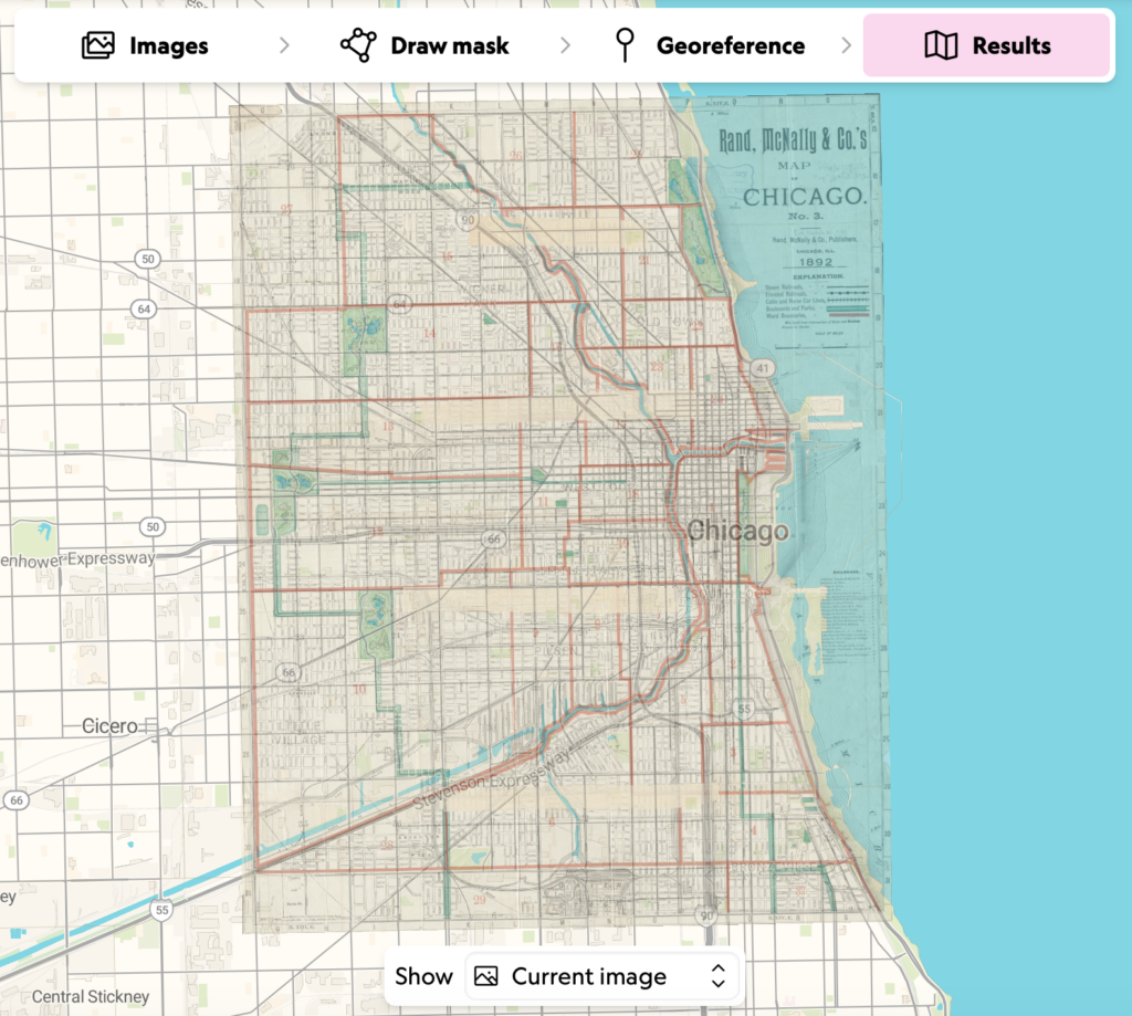
Upon creating the geo-rectified map, the possibilities for uncovering information is expanded: like with the Mapping Inequality project, masking and dividing areas of older maps such as this one may give viewers a better understanding of how history has impacted today’s societies. Beyond masking different areas of the geo-rectified map, the next steps would be to fill out information and categorize said areas using software such as ArcGIS. This process of may also help identify areas of older maps that were previously confusing or unmarked.
One issue with geo-referencing maps with tools such as Allmaps is the fact that the process may lead to some inaccuracies. Beyond my simple misplacement of control points leading to a rather askew result, maps that are proportionally positioned to their modern counterparts may still mislead viewers: again, places change constantly and not everything may line up. This process of geo-referencing would not help researchers asking “how can these maps help us in modern constructions of the city?” Not only are the old maps outdated, geo-referencing seems like an unneeded process for designing modern architecture. Then again, older maps of Chicago may grant some understanding of what can be found underneath the city today.