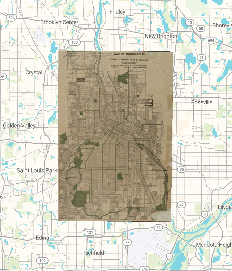
https://viewer.allmaps.org/?url=https://annotations.allmaps.org/images/49e0558a0c27d513
The process of georeferencing changed my understanding of spatial DH projects by showing me how digital tools can break the barrier of time by combining historical maps with contemporary maps. Many spatial DH projects, such as Baseball Nation, are interactive and provide useful information, but they do not always allow users to directly compare historical and contemporary geographic data. Georeferencing offers a way to connect the past with the present.
After completing the georeferencing process in Allmaps Editor, I learned that aligned maps can be exported in several formats, including IIIF Georeference Annotations (JSON), XYZ Tile URLs, GeoJSON, and control points for GIS platforms such as QGIS. These formats allow researchers to display historical maps online and conduct further spatial analysis.
Georectified maps create many possibilities for humanities research. Scholars can compare the layouts of cities in the past and present, identify changes in streets and buildings, and investigate the historical reasons behind these transformations. Urban planners could also use these maps to understand earlier city designs and examine how historical planning decisions influence modern urban environments.
However, georeferencing has limitations. Researchers need reliable reference points that appear on both historical and contemporary maps. If streets have disappeared or the landscape has changed significantly, accurately aligning maps can become difficult. Historical maps may also contain distortions that georeferencing cannot completely correct.
Therefore, this method is not appropriate for every research question. For example, it cannot independently explain why a neighborhood changed or reveal the personal experiences of people who lived there. It is also less useful for studying historical events without a clear spatial dimension. In these cases, researchers should combine maps with written records, photographs, and other historical sources.
Overall, georeferencing is a valuable tool for connecting historical geography with the present, but it works best when combined with other forms of historical evidence. In the future, I would like to combine georeferencing with 3D modeling and other digital humanities technologies to investigate historical places and cultures.