The Map
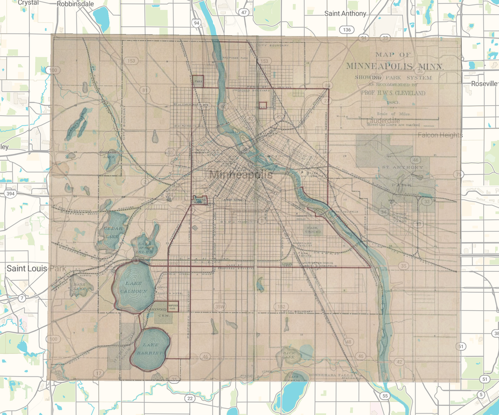
I georeferenced the “Map of Minneapolis, Minn. Hennepin County Library’s Special Collections” in the Minnesota Digital Library. Showing Park System as Recommended by Prof. H.W.S. Cleveland (1883) It was designed by landscape architect Horace Cleveland to sell the city on a park system. His plan was to eventually be the Grand Rounds parkway. The map shows the streets, railroads and streetcar lines as they existed then, and Cleveland’s proposed parks and boulevards in red.
The Procedure
I imported the map into the Allmaps Editor via its IIIF manifest, masked out the paper border, and set control points. My first three points came in along the west side: Lake Harriet, Lake Calhoun, and Cedar Lake. Allmaps pulled the map into a skewed wedge that reached toward Eagan. When I added points on the Mississippi at Nicollet Island, at the river’s big bend, and in the lower right, the map settled in the city. Now the lakes and the river through downtown are very much in line with the modern basemap.
What I Discovered
“Lake Amelia” which is on today’s Lake Nokomis and “Rice Lake” on Lake Hiawatha fade between the maps, while “Bass Lake” has no modern water under it. Cleveland’s red boulevards still follow the parkways around the lakes. When I had scored points myself, I read projects like Mapping Inequality differently; every overlay is built on somebody’s decision about which points to trust.
What’s Next?
Allmaps exports a viewer link, a IIIF georeference annotation in JSON, and XYZ tiles that loads into other GIS tools. Next, I’d overlay the HOLC map of Minneapolis and see which neighborhoods got the parks, and I’d plot Cleveland’s boulevards as vector lines.
Limits
This map is folded in a book fold down the center, and folds the image. Dredged shorelines are bad control points. The map is a mix of existing features and proposals. This method also doesn’t work for sketch maps and questions about how people experienced place.