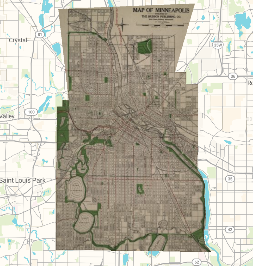
For this week’s lab, I used AllMaps to georeference a historical map of Minneapolis. The process involved taking an older map and aligning it with a modern map by identifying locations that exist in both. I selected a map published by the Hudson Publishing Company and used recognizable streets and geographical features to position it over present-day Minneapolis. AllMaps made this process surprisingly straightforward. The “Map” page allows for some more complicated things. It lets the map transform into different forms like helmert, polynomial, and thin plate spline. The edit mask supports JSON and SVG. Although I did not use this feature, I am sure it becomes useful for more complicated and precise georeferencing projects.
This activity helped me better understand the spatial Digital Humanities projects we explored earlier. Before this lab, I hadn’t fully considered the work involved in making historical maps compatible with modern mapping technology. Georeferencing allows researchers to compare geographic information across different periods, making it easier to visualize how cities and communities have changed over time. AllMaps also provides ways to access and reuse rectified maps, including through IIIF resources and web-based map services, which makes it possible to incorporate them into other digital projects.
One particularly interesting possibility would be using georeferenced maps to study urban development, which is my Econ Comps topic. Looking at Minneapolis, I could compare historical street layouts, neighborhoods, and green spaces with their modern counterparts. This could help answer questions about how the city expanded, which areas experienced the most development, and how transportation infrastructure influenced urban growth. A next step might involve georeferencing several maps from different decades to create a more detailed visualization of these changes.
There are limitations to this method. Historical maps are not always geographically accurate, and differences in scale or the placement of landmarks can make precise alignment difficult. I was able to get everything aligned pretty well, but it is far from perfect. These inaccuracies could create problems for research requiring extremely precise measurements.
Overall, I think georeferencing is especially useful for projects examining changes in urban environments over time. However, it would be less appropriate for research requiring exact property boundaries or highly accurate historical distances without additional verification.