I used AllMaps to georeference a historical map of Minneapolis, Minnesota. The process involved matching locations on the historical map with their corresponding locations on a modern map. I placed 11 control points throughout the city, primarily around downtown Minneapolis, and used other recognizable locations, such as Lake Harriet. After placing these points, AllMaps was able to align the historical map with the modern map, allowing me to compare the two. Here is a link to my work
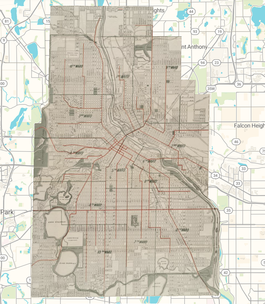
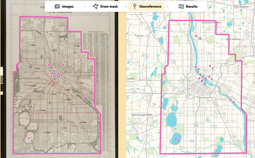
This assignment changed my understanding of spatial Digital Humanities projects because I had not previously considered the work required to make historical maps compatible with modern mapping systems. Before this assignment, I mainly thought of maps as tools for displaying locations. However, georeferencing showed me how maps from different periods can be compared to study historical changes. One interesting part of the process was seeing how some features, such as the Mississippi River and the lakes around Minneapolis, remained recognizable even though the surrounding city had developed. AllMaps also provides different ways to access the georeferenced map, including georeference annotations in JSON format and map tiles that can be used in other digital mapping applications. This makes the results useful beyond simply viewing the map on the AllMaps website.
I think georeferencing offers many possibilities for Digital Humanities research. For example, researchers could use historical maps to examine how Minneapolis expanded over time, how neighborhoods changed, or how transportation networks developed. A possible next step would be to compare maps from multiple decades to identify changes in the city’s infrastructure and urban development.
However, this process has limitations. Historical maps are not always geographically accurate, and some landmarks may have changed or disappeared entirely. This can make it difficult to identify precise control points and align maps correctly. Additionally, georeferencing may not be appropriate for research questions that focus on personal experiences, cultural beliefs, or other subjects that cannot easily be represented geographically. Overall, this assignment helped me understand how georeferencing can make historical maps more useful for studying geographical changes and exploring the development of cities over time.
I found your reflection interesting, especially because you highlighted the amount of work involved in making historical maps compatible with modern mapping systems. Your use of 11 control points seems like it helped create a more accurate alignment, and I liked how you pointed out the contrast between unchanged natural landmarks and the growth of the city around them. I also agree with your discussion of the limitations of georeferencing. While it is a powerful tool for studying urban development and infrastructure changes, it cannot fully capture the social and cultural experiences that shape a city’s history.