I chose to work with a map of Elliot Park in Minneapolis, MN that details the improvements planned in 1910. I found the actual process of georectifying my map very straight forward when using Allmaps. I excluded the border of the map for better readability using the mask tool and, because of the odd shape of my map, I placed eight pins and ended up with what I consider a “decent” result for fifteen minutes of work.
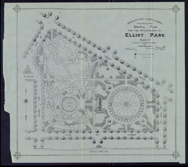
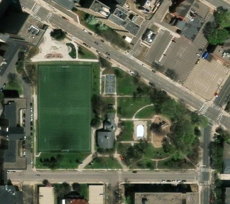
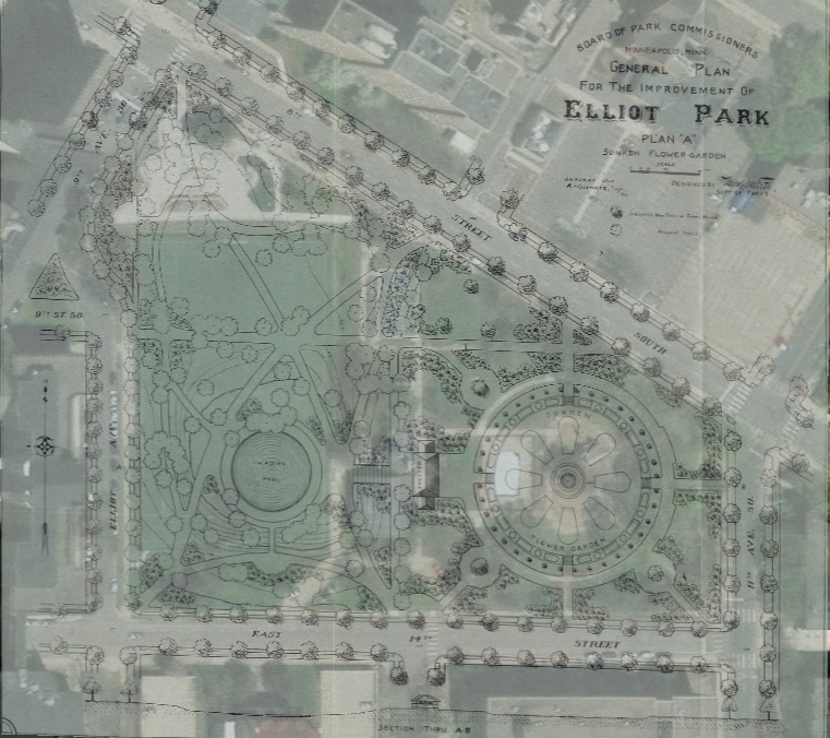
I found georectifying a map much easier than I had expected. My experience was no doubt aided by choosing a map covering a small area and one whose present location is mostly the same. Attempting to georectify a map when buildings have been torn down, streets have changed, or in older locations would be more difficult. In particular, aligning bigger and more complicated maps pose issues.
Although I only exported my work as a screenshot and a link, it is also possible to export an Allmaps map as a GeoJSON file, open it within MapLibre GL or GeoTIFF, or as either XYZ map tiles or Georeference Annotation. Of these, I am only slightly familiar with GeoJSON and XYZ map tiles from the work we have done in class.
Because of this, I don’t personally have many options yet. However, with a better base of knowledge, rectified maps are an excellent way to showcase the history of locations next to their present appearance. Obviously, rectified maps and other representations of spacial data are not helpful when researching topics that do not include or do not need explanations of their physical space(s), but I would argue that most inquiries would be helped by having that understanding.
As many of the projects we looked at demonstrated, maps are an accessible way to share a lot of information quickly. Attempting to verbally explain a map to someone would take a significant amount of time and effort and would likely end with the listener “seeing” an incorrect version of the map anyway. I wouldn’t say that this assignment changed how I think about maps (I love maps), but it did provide me with a better understanding of how digital maps work and how they can be helpful when translating history.
Nice job georeferencing Elliot Park Lily! I agree with what you said about how the assignment helped you comprehend digital maps and understanding history. Often times, I saw a map as a drawn, printed, or digital representation of a physical location. This assignment definitely changed my perspective and it made me realize how much meaning is behind the creation of maps.