URL from the mapping website–
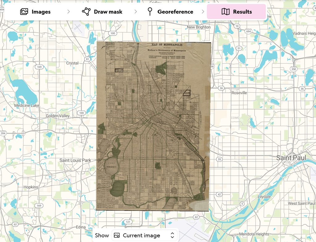
For this project, I used All Maps Editor to overlay a map of Minneapolis from 1909 onto a current-day map of Minneapolis. The process gave me a much better understanding of spatial digital humanities and how maps can be used as historical sources. Unlike many other digital humanities projects that focus on text or images, maps reveal social, political, and environmental conditions at a specific moment in time. Seeing the historical map aligned with the modern city allowed me to observe how Minneapolis has changed while also identifying features that have remained stable.
After rectifying the map, I could access it in several formats, including Polynomial, Thin Plate Spline, and Helmert transformations. A Polynomial transformation stretches and warps the map using mathematical equations to fit control points. A Thin Plate Spline transformation bends the map like a flexible sheet, allowing for local adjustments that can correct irregular distortions. A Helmert transformation applies only scaling, rotation, and translation, preserving the map’s overall shape while aligning it with modern coordinates.
Having a georectified map creates many research opportunities. I could compare land use, transportation networks, neighborhoods, and environmental features across time. One interesting observation was that rivers and other bodies of water remained generally in the same locations, while buildings, roads, and infrastructure changed significantly. Future work could involve comparing multiple historical maps from different decades to track urban growth and development.
However, georeferencing has limitations. Older maps were often less accurate than modern maps and may contain surveying errors, artistic distortions, or incomplete information. Choosing control points can introduce human error, and some landmarks may no longer exist, making accurate alignment difficult. Different transformation methods can also produce different results.
This method would not be appropriate for research questions that require highly precise measurements or studies focused on topics that have little spatial component. Georectified maps are powerful tools, but they should always be interpreted with an understanding of their historical and technical limitations.