Georectifying a historical map was a relatively straightforward process, although it required some patience, attention to detail, and a bit of time. It was interesting to see how an older map could be connected to present-day geographic data, making it easier to explore the relationship between historical and modern landscapes.
Before working with georectification myself, I had not thought as much about the technical process behind creating interactive historical maps. Seeing how much alignment and adjustment goes into the process helped me recognize that these projects are not simply visual presentations of historical information; they also involve technical decisions that can influence how users interpret the data.
Georeferencing
After georectifying a map, several possibilities open up for further research. Researchers could compare historical maps with modern maps to examine changes in city layouts, transportation networks, land use, or political boundaries. Researchers could also layer additional historical documents or geographic datasets over the map to investigate relationships between places and events. A probable next step would be to create a more interactive comparison between the historical map and its modern equivalent.
However, georeferencing also has limitations. Historical maps may contain inaccurate measurements, distorted proportions, or inconsistent geographic information, as you can tell from my own example. Even when a map is aligned with modern coordinates, that does not mean its original information is completely accurate; times change. When scouring this map, I found that several street names. The placement of control points can also influence the final result!
For these reasons, georeferencing would not be appropriate for every research question. It may be less useful when studying documents that lack meaningful geographic references or when the research depends on precise measurements that the original map cannot reliably provide. Overall, this process demonstrated how digital tools can make historical sources more interactive and useful for research, while also emphasizing the importance of understanding their limitations.
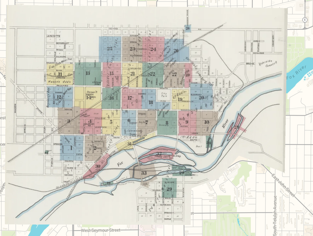
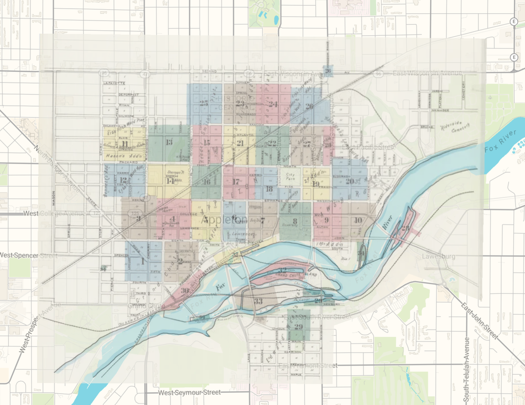
I tried multiple links, and this is the only one that kind of works: LINK