By: Jake, Brayden, & Faimon
For our lab this week, we documented the Stone Bridge located in Carleton College’s Japanese Garden. The bridge is one of the garden’s features, connecting different parts of the landscape and contributing to its overall design. Throughout the week, we used different digital modeling techniques to capture the bridge and its surroundings. We used Scaniverse, Polycam, and MetaShape to create digital representations of the bridge, allowing us to explore different ways of documenting cultural and historical spaces.
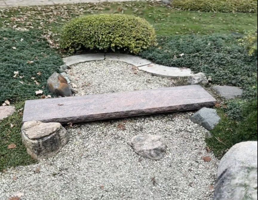
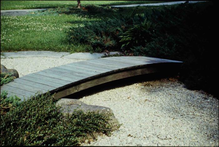
One thing we noticed while modeling the bridge was how much more attention we paid to its smaller details than we normally would. When walking through the garden, it is easy to overlook individual features without thinking about their structure or significance. However, creating a digital model required us to observe the bridge from different angles and consider its shape, materials, and surroundings. This helped us develop a better understanding of the bridge than we would have gained from simply looking at photographs or maps. While photographs capture only one perspective, 3D models let viewers examine an object from multiple angles.
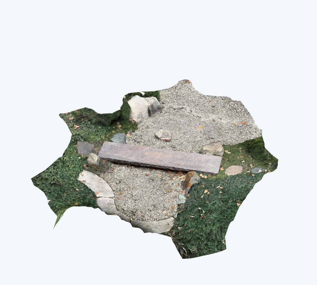
Another interesting part of this project was comparing the different modeling methods. Scaniverse and MetaShape allowed us to create 3D representations of the bridge, while Polycam provided a panoramic view of the surrounding garden. The panorama captured the paths, stone features, trees, and nearby buildings, helping us better understand how the bridge fits into the larger environment. Each method offered a different perspective, showing how multiple digital tools can work together to document the same location. Since the panoramic image and video files were too large to upload directly to our WordPress site, we have provided links to view the photograph and video through Google Drive.
We also created a polygon feature layer in ArcGIS Online to document the location and outline of the Stone Bridge within Carleton’s Japanese Garden. You can view our Stone Bridge map layer.
We also think that creating digital models changes how we interact with and communicate the history of our campus. Instead of being passive observers, we became active participants in documenting a place that students might otherwise walk past without much thought. Combining these models with archival photographs and digital mapping allows us to connect the garden’s physical features with its history. It also gives people who cannot visit Carleton an opportunity to explore the garden virtually and develop a better understanding of its layout and features.
Overall, this project showed us how photogrammetry and other digital humanities tools can make cultural heritage more accessible and interactive. By documenting the Stone Bridge using different methods, we gained a greater appreciation for the details of the garden and the different ways technology can help preserve and share historical spaces.
I agree that this project helps modelers have a better sense of the small details of the object of interest. I also think it is exciting to be able to participate actively in documenting the campus. It is great that we are able to contribute to the archive and capture space via a number of different modeling softwares. This will be really interesting to look at for future students who are curious about the campus at this time.
Hi!
I am impressed with how your model of the Stone Bridge turned out! I also found that I paid more attention than I usually would to smaller features of my object during the modeling process. I agree that creating models can help us interact with Carleton College’s history, but I’m curious to know more about what that would look like in practice.
I can definitely relate to the different methods of modeling being an interesting process. Seeing the different perspectives and work needed to properly complete each one was really nice. Being able to be in the environment we were capturing was also such a nice experience, because it really allowed us to almost build connections with the garden through viewing it and observing its many different details. Photogrammetry really is an amazing way to make visuals like these very accessible to the public.
I think you did a great job capturing the stone bridge from different angles and showing the details of its structure. I especially like how photogrammetry allows people to explore the bridge digitally and notice details they might miss just walking through the Japanese Garden.
Hello, I agree that photogrammetry can really improve access to cultural and historical artifacts and sites, as well as create an interactive experience. I was surprised by your 3D model, it seems to really successfully represent the stone bridge, despite the bridge seeming like something that would be tough to model due to its flat nature, and proximity to the ground. I think the inclusion of the area directly surrounding the bridge helps a lot to contextualize the bridge within the space. I also think it’s interesting to see the recent photo next to the archival one; they appear to be different bridges? I guess they replaced the older one with the current stone bridge; it’s interesting to think about that aspect of archiving the Japanese Garden. We aren’t able to 3D model former features, so the best we can do is model the ones currently in place. Great post!
I really liked the 3D model of the Stone Bridge! Being able to look at it from different angles made it feel much more interactive than just looking at a picture. I also thought it was cool how the model captured so many of the smaller details that I probably wouldn’t have noticed just walking through the garden. It really shows how useful these tools can be for documenting places around campus.