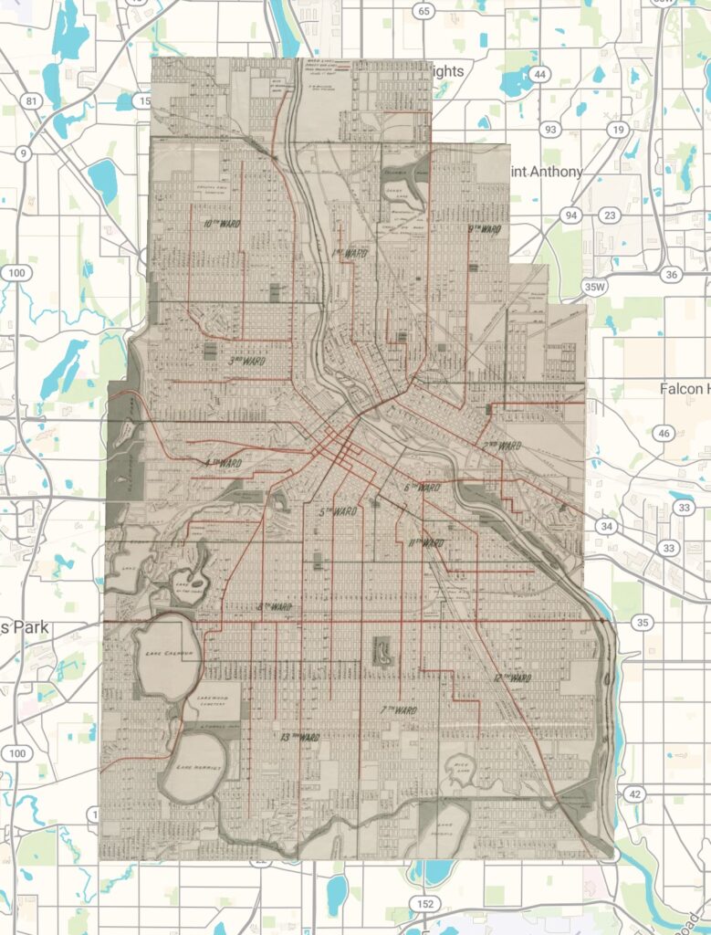
I have embedded the link to the map here.
Reflection
Working with georeferencing changed the way I think about spatial Digital Humanities projects. Before doing this exercise, I mostly thought of old maps as historical objects that could be examined by themselves. After placing an old map over a modern map, I realized that GIS gives us a much better way to connect historical materials to real-world locations. We can also ask where those places are today and how the same space has changed over time.
One thing I found useful about the georeferencing website was that it gives us tools to control how visible the old map is compared with the modern map underneath it. By changing the transparency, I could see where roads, blocks, lakes, and other features lined up and where they did not. This made the differences between the old map’s projection and the current map much easier to notice.
On the Map page, the rectified map can also be accessed in different digital forms, including a georeferenced image and web-mapping formats such as map tiles or WMS layers, which makes it possible to use the result in other GIS projects. Once a map is georeferenced, I think an interesting next step would be to compare the historical map with a current map and take notes on what has changed. I could look for streets that disappeared, neighborhoods that expanded, or natural features that were altered. This could eventually become a larger project about urban development or changes in land use.
At the same time, georeferencing has some limits. One problem is that old maps may contain distortions and inaccurate measurements, so the historical and modern maps may never line up perfectly. It can also be difficult to show a clear timeline between the two maps. Georeferencing helps compare two moments, but it does not explain what happened in between. Because of this, the method would be less useful for research questions that depend on events that cannot be tied clearly to specific locations. It works best when space itself is an important part of the historical question.