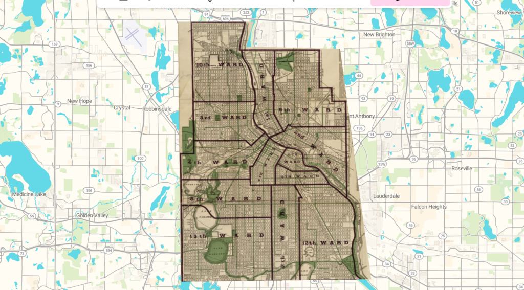
Working with mapping and georeferencing on my own gave me a much greater understanding of the work that goes along with it. I had no idea how tedious it was to plot and align every single point or how much work it was to make it look nice. When we’ve looked at visualizations in the past that have involved maps, I overlooked things such as the overlays and details just because I didn’t understand how much work went into even the seemingly most basic elements of the display. When it came to my own process, I used Allmaps to align an older map over a modern version of the same thing. This involved creating a mask of the older map and then aligning that with points to the modern locations that it corresponds with. This was a fun but challenging process trying to align everything and make it look as good as I can.
This map is now able to be seen in multiple different formats. Thanks to Almapps, I am able to view the map in forms such as helmet, plate spine, and polynomial. I am also able to view the map on different projections of the globe. This allows for more diverse viewings of projections.
Once I have a georectified map, I can use it to compare older locations with how they look today. I think this would be interesting for looking at how cities have grown or how roads and land use have changed over time. My next step would be to check how well everything lines up and then add other maps or information to better understand the changes. Working with Allmaps helped me realize how much these comparisons depend on the work that goes into aligning the maps.
One problem with georeferencing is that the older map might not have been accurate in the first place. Even when I try to align every point carefully, some parts might still look wrong because of how the original map was drawn. Buildings and roads might also have changed or disappeared, which would make finding matching points more difficult. I think it is also important to consider why the map was created and what the mapmaker chose to include or leave out.
I don’t think this method would be as useful for research questions about people’s beliefs or experiences unless there was a connection to specific locations. A map could show where people lived, but it would take other sources to understand how they felt about living there. I also think it would be difficult to use this method with maps that were meant to tell a story or represent an imagined place because trying to align them with modern locations could change how we understand them.
https://viewer.allmaps.org/?url=https://annotations.allmaps.org/maps/8405ba077f2ea233