Virtual Mappa mundi
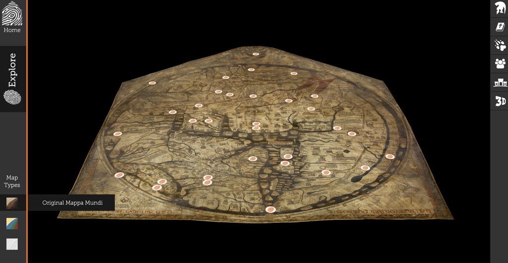
A screenshot of the digital Mappa Mundi project
This digital humanities project features an interactive version of the Hereford Mappa Mundi, a medieval map preserved in Hereford Cathedral. The site also shows the historical, mythic, and religious narratives embedded in the map.
Sources (Assets)
Physical Artifact: The Hereford Mappa Mundi, created around 1300, is the largest surviving medieval map of the known world.
Digital Assets:
- Visual Data: High-resolution images of the entire map captured by HD cameras, alongside a 3D surface scan.
- Textual Data: Transcriptions of medieval place names and inscriptions, paired with modern English translations.
- Metadata: Spatial coordinates (X, Y) assigned to specific locations and features, categorized into themes such as biblical stories, myths, and geography.
- Contextual Data: Historical and mythological background information researched and written by scholars.
Processes (services)
The project team integrated these diverse data assets into an interactive web platform. First, they uploaded high-definition images using image-tiling technology to allow smooth zooming. Next, they mapped interactive hotspots using coordinate settings, directly linking specific visual elements—such as illustrations, towns, and mythical beasts—to their corresponding transcriptions, translations, and scholarly commentaries. All the listed data are used to build this interactive online platform.
Presentation (display)
The interface features an interactive viewer that enables users to seamlessly zoom in, pan around, and click on hotspots to reveal pop-up annotations. It also offers thematic filtering, allowing users to browse locations by specific categories (e.g., Beasts & Monsters, Biblical Stories) and jump directly to relevant features on the map. Designed for both academic researchers and the general public, the layout is clear, intuitive, and accessible, ensuring that anyone can easily explore the map’s complex stories. Thus, this project is open access to everyone who is interested in exploring the map.
Question raised through breaking down
While precise digitization enables viewers to examine the map in unprecedented detail and easily navigate its stories, it inevitably decontextualizes the physical artifact. By putting the map on a 2D screen, the digital format strips away the sense of the parchment and the sacred, historical atmosphere of Hereford Cathedral, where it is located. Since these contextual senses and information are part of the project itself, how can digital humanities projects offset this loss of physical presence and spatial context?